Rosalie (Rosalie)
Rosalie is a village in Dominica. It is located in Saint David Parish at the northern end of Rosalie Bay, on the central east coast of the island, close to the mouth of the Rosalie River.
Map - Rosalie (Rosalie)
Map


Country - Dominica
 |
 |
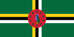
| Flag of Dominica | |
The island was settled by the Arawak arriving from South America in the fifth century. The Kalinago displaced the Arawak by the 15th century. Columbus is said to have passed the island on Sunday, 3 November 1493. It was later colonised by Europeans, predominantly by the French from the 1690s to 1763. The French imported enslaved people from West Africa to Dominica to work on coffee plantations. Great Britain took possession in 1763 after the Seven Years' War, and it gradually established English as its official language. The island gained independence as a republic in 1978.
Currency / Language
| ISO | Currency | Symbol | Significant figures |
|---|---|---|---|
| XCD | East Caribbean dollar | $ | 2 |
| ISO | Language |
|---|---|
| EN | English language |